Southwest faces more severe weather, flash flooding as Colorado Gov. declares state of emergency
This story deserves to be shared
Send it to someone who'd care, or post it on your networks.

Southwest faces another round of severe weather, flash flooding after rare Tornado Watches Another round of dangerous severe weather will shift eastward and develop over New Mexico Friday afternoon after storms triggered flash flooding and evacuations across parts of the Four Corners region Thursday. Damaging wind gusts are expected to be the main threat, but a few tornadoes are also possible. Arizona was placed under Tornado Watches on both Wednesday and Thursday, the first Tornado Watches issued in the state since 2010. Flash flooding triggered mandatory evacuations in southern Utah on Thursday. A Level 2 out of 4 flash flood risk covers parts of southern New Mexico and West Texas Friday, while a broader Level 1 risk covers much of the rest of New Mexico, including Albuquerque and Santa Fe. THE TAKEAWAY A Level 2 out of 5 severe weather threat has been issued for southern New Mexico. Damaging wind gusts are expected to be the main threat, but a few tornadoes are also possible. A Level 2 out of 4 flash flood risk covers parts of southern New Mexico and West Texas, while a broader Level 1 risk covers much of the rest of New Mexico, including Albuquerque and Santa Fe. Colorado Gov.
This article is an excerpt. To read the full content, visit the original source. Fox Weather
Related articles

Hunter's Moon: When and where to see October's full moon
October’s full moon, known as the “Hunter’s moon” is coming this weekend, but weather might make the view a hit or miss for some areas. The full moon peaks late Sunday night, or early Monday morning, for anyone in the Eastern Daylight Time Zone: EDT: 12:12 am (Monday)CDT: 11:12 pm (Sunday)MDT: 10:12 pm (Sunday)PDT, MST: 9:12 pm (Sunday)Whether or not the weather will let you see the full moon is another question. A large cold front and developing low pressure system stretching across the middle third of the country will create less than ideal viewing conditions for the Plains and Upper Midwest. The Pacific Northwest is facing a similar problem with a storm system moving in from the Pacific Ocean. A super moon but not a supermoonIf you manage to get outside to view the full moon, you might describe the experience as “super”, but it is not in fact a supermoon. A supermoon happens when the moon is full at the same time as it is at its perigee, or the point in its orbit closest to the Earth. Get More of Our News on GoogleSet The Weather Company as a 'Preferred Source' to get quicker access to the news you value. The next two supermoons happen on Nov. 24 and Dec. 24.

Weather Whiz: October 25
How well have you been paying attention to the weather this week? Here are five questions that will test your knowledge of what's been going on. QUESTIONSHow many national parks does America have now that the newest — Chiricahua National Monument in southeastern Arizona — was made official on Tuesday? Cold fronts are driving one of the year's biggest migrations of what animal right now?_______ farming draws on the USDA’s principles for soil health: Disturb the soil as little as possible, keep it covered, keep living roots in the ground and grow a mix of plants. Glendale, California, is fighting wildfire risk with an appetite, sending a hungry horde of 200 _______ into high fire hazard zones to chomp down on grass and weeds. This week, a deadly magnitude 7.0 earthquake struck a remote region of which country?.... ANSWERS64HawksRegenerativeGoatsTibetHow did you do this week? Come back for more exciting weather questions next week, or risk showing up to trivia night unprepared! Get More of Our News on GoogleSet The Weather Company as a 'Preferred Source' to get quicker access to the news you value.

Weather Of The World: October 25
Wander the world one snapshot at a time. Explore striking moments of weather in motion in this week's slideshow. ByAda Wood•2 hours agoUpdated: October 25, 2026, 7:19 am EDTPublished: October 25, 2026, 7:00 am EDTA wave breaks on the Phare du Mole lighthouse during the Austen storm in Saint Malo, western France, on Oct. 23, 2026, before the start of the 13th Route du Rhum Destination Guadeloupe.(Loic VENANCE/AFP via Getty Images)From waves crashing at a lighthouse in France to fresh snow falling at a lake in Germany, it has been another busy week of weather around the world. Here are some of the most jaw-dropping and awe-inspiring weather photos we found this week. A view of Lake Seealpsee where fresh snow has fallen in the higher elevations of the Allgäu Alps in Germany.(Jan Eifert/picture alliance via Getty Images)This aerial photograph taken on Oct. 18, 2026 shows steam rising from a chimney shrouded in a blanket of fog on an autumn morning in Warsaw, Poland.(Sergei GAPON / AFP via Getty Images)A rainbow in central Lyon, France, on Oct. 23, 2026.(OLIVIER CHASSIGNOLE/AFP via Getty Images)This photograph shows the Goury Lighthouse off La Hague, northwestern France, on Oct.

Were Monet's skies really 19th-century pollution reports?
(Monet, "Charing Cross Bridge," 1899. (Thyssen-Bornemisza Museum))They're some of the most beautiful skies ever painted. They may also be some of the dirtiest. The dreamlike haze hanging over the canvases of J. M. W. Turner and Claude Monet has long been celebrated as a stylistic triumph. But recently, some atmospheric scientists have argued that these masterpiece skies may also reveal something more concrete: a record of the coal smoke that choked London and Paris during the Industrial Revolution. In a 2023 study published in the journal PNAS, Anna Lea Albright of Sorbonne University and Peter Huybers of Harvard University tested whether the two painters' work tracked the rise of 19th-century air pollution. They analyzed 60 oil paintings by Turner (spanning 1796 to 1850), and 38 by Monet (spanning 1864 to 1901). They measured two things: contrast, or how crisp the edges are, and intensity, or how white and bright the image appears.(Turner, "Apullia in Search of Appullus," 1814 (Tate))The physics behind the research is simple. Burning coal releases sulfur dioxide, which forms tiny sulfate particles in the air.
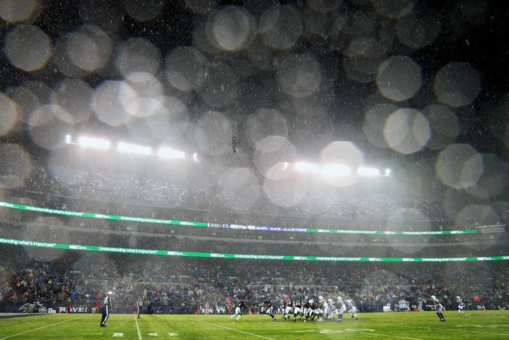
Weather can cost you a fantasy football win, study finds
Heavy rain falls as Quarterback Joe Flacco #5 hands the ball off to running back Alex Collins #34 of the Baltimore Ravens against the Indianapolis Colts in the third quarter at M&T Bank Stadium on Dec. 23, 2017 in Baltimore, Maryland.(Photo by Patrick Smith/Getty Images)Fantasy football players take their hobby seriously: They listen to daily podcasts, pore through stats and check rankings constantly in search of an edge over their competition. Well, maybe they should add one more report to check before NFL Sundays: the forecast.(MORE: Why you can't see rain during a football game broadcast)A new comprehensive study released by HeatRadar analyzes over 4,000 outdoor NFL team-games from 2014 to 2025 to quantify the true impact of wind and rain on offensive production. By measuring each team's performance in bad weather directly against its own calm, dry baseline during the same season, researchers found that both elements usually have far less effect than commonly assumed below certain thresholds, but cause sharp declines once critical tipping points are reached.
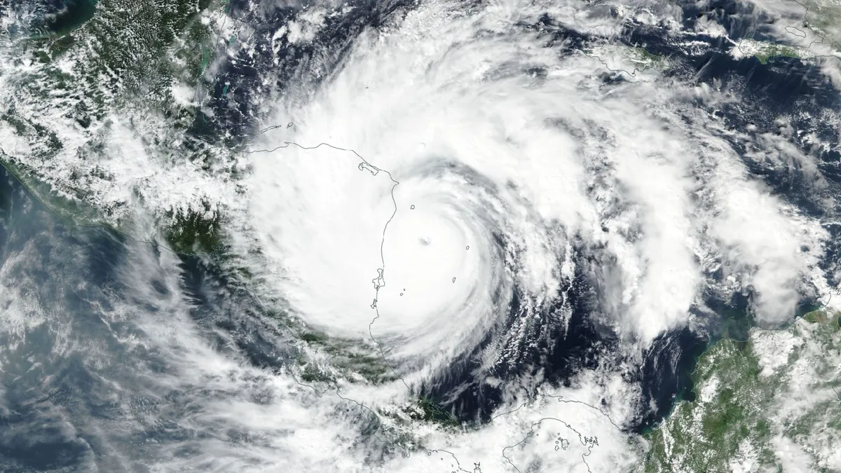
November hurricanes are still possible as the season winds down
A hurricane is the farthest thing from our minds as the leaves change and temperatures drop. But the season isn’t done just yet, and even a quiet season can have a few tricks up its sleeve heading into late autumn. Here’s a look at what we might expect over the next couple of weeks as we enter the final stretch of this near-record quiet hurricane season. DON’T MISS: Autumn can still produce intense hurricanes across the AtlanticA raging El Niño in the neighbouring Pacific Ocean has kept this Atlantic hurricane season exceptionally quiet. Nine of this year’s ten named storms only achieved tropical storm intensity. Isaias, which set a record for its lateness, grew into the season’s sole hurricane before it slammed into Florida’s coastline on Oct. 9. Atlantic hurricane season officially runs through Nov. 30. Based on climatology, a little more than 90 per cent of an average hurricane season’s total activity is behind us by the weekend before Halloween. Content continues belowBut that remaining 10 per cent can pack a punch if all the right conditions align. The most likely spot for tropical formation this late in the season is the western Caribbean Sea and the southwestern Atlantic.
0 comments
No comments yet. Be the first to share your thoughts!